Categories
Seedcorn Project

Arriving and Thriving in Loughborough: Belonging and Community

About the project

The digital realm can play a vital role in shaping and developing perceptions of community across the globe. Yet, the digital is often framed as a space of division as opposed to a resource to aid inclusion into places. This pilot study seeks to trial novel data visualisation and storytelling methods to explore people moving to Loughborough develop belonging/community connectedness, and how digital platforms can be used as a resource to do so. The aim of this project is to explore how people who have moved to Loughborough develop a sense of belonging/community, and whether additional resources are needed that could support them and future new arrivals. The project does this through innovative creative digital methodologies: (1) the use of miro, an online collaborative tool to discover places with meaning for new arrivals, and (2) storytelling workshops to identify how places have meaning in creating Loughborough’s community. The findings will be presented in the ArcGIS storymap ‘Arriving and Thriving in Loughborough,’ which can be utilised as a resource to aid future new arrivals. This project matters because, to attract new businesses to Loughborough, we also need to ensure that we can attract and retain a workforce with relevant skills. As a result, understanding how new arrivals develop a sense of belonging/community will be vital in supporting Loughborough’s local economy.

Outcomes

The project produced three digital StoryMaps for the Loughborough Stories platform as part of the TOWN Observatory (“Thriving in Loughborough: Connecting Campus and Town”, “Step into Nature” and “Places which Develop or Hinder Belonging”), offering practical and emotional guidance to help new arrivals navigate the town.  

Collaborative workshops and online Miro activities enabled participants to identify meaningful places and engage in discussions that strengthened community connections. The project also worked to bridge gaps within Loughborough, particularly between the university and the town, through targeted engagement. 

Insights and reflections from the community engagement process were compiled into a report titled “Reflections on Community Engagement”, which aimed to inform future research and practice. 

Pathways to Impact

Despite limited immediate impact due to sample constraints, the project uncovered multiple future pathways and laid the foundations for a transferable engagement framework, one that could inform inclusive community‑building approaches in other towns and cities. 

Academic The project piloted innovative digital storytelling methods (Miro, ArcGIS StoryMaps) as tools for community‑focused research and contributed insights into how new arrivals build a sense of belonging in Loughborough. It also produced the “Reflections on Community Engagement” report. These methods could inform new interdisciplinary research approaches in social geography and digital inclusion. 

Societal Through focus groups and participatory digital tools, the project encouraged dialogue between university and town communities and created two StoryMaps to support newcomers. It also highlighted issues around digital inclusion and cultural sensitivity. This could lead to stronger long‑term trust between communities, increased participation in engagement activities, and measurable improvements in newcomer experiences. 

Economic The project offered early evidence that belonging is linked to attracting and retaining skilled workers and has relevance for local policy discussions around population growth and integration. These findings could encourage employers to adopt belonging‑focused onboarding practices, potentially reducing turnover and supporting regional economic stability. 

Community & Culture The project identified practical needs of newcomers and emphasised the diverse experiences of different arrival groups, which could lead to more culturally inclusive resources in the future, increased use of digital StoryMaps, and greater participation in local cultural events. 

Future Actions: Future actions could focus on broadening community representation by involving a wider range of new arrivals and developing stakeholder maps and user journeys; addressing digital inclusion through partnerships with community organisations and engagement with both digitally confident and digitally excluded groups; creating practical, community‑led resources that reflect cultural and accessibility needs and align with local support services; strengthening policy integration by sharing findings with local authorities and exploring how the approach could be adapted for other towns; and ensuring sustainability through ongoing engagement via community networks and the development of hybrid digital and offline resources. 

Project team and roles

Dr Sophie Cranston, (Lead Investigator) Geography and Environment, PI
Dr David Maidment, Sport, Exercise and Health Sciences, Co-I
Prof Sarah Mills, Geography and Environment, Co-I
Dr Michelle Richey, Loughborough Business School, Co-I
Rosanna Cant, Geography and Environment, RA
Ellie Moore, Criminology, Social Policy, Sociology, RA
Masa Nooh, Geography and Environment, RA

Categories
Seedcorn Project

Illuminating Loughborough

Lights Map. Source: Image created by authors of Illuminating Loughborough Project

About the project

Assessing how lighting impacts physical activity and active travel through community perceptions.
 
Managing lighting of public spaces effectively is a challenge that affects users of roads and green spaces, local councils, law enforcement, and wildlife alike; people need an environment in which they feel safe to be physically active (e.g. cycling, walking, using outdoor gym equipment), while the negative effects on the environment are minimised and the operating funds used efficiently. 

Illuminating Loughborough conducts a novel assessment of lighting quality in Loughborough that links a quantitative lighting appraisal with subjective community-based perceptions using innovative digital technology for data collection and analysis, including digital participation platforms. The results will not only advance research but also support the local community, for example through the provision of additional lighting in Southfields Park. The project is integrated in the work conducted as part of the Active Healthy Living and Connected Loughborough projects and includes the collection and publication of community feedback in The Impact Hub’s StoryMaps platform.

Key Activities to date

Infrastructure Enhancements – Significant enhancements were implemented in Loughborough’s Southfields Park, including the installation of solar-powered spotlights, outdoor gym equipment, a series of distance-marked activity tracks, pathway refurbishment and vegetation clearance. 

Community Engagement – Through their involvement in pre‑enhancement community tours, local residents directly influenced the design of the planned future infrastructure enhancements. Post-investment community tours were also conducted to gather resident feedback on satisfaction, perceived safety and accessibility. 

Professional Lighting Assessment – A baseline evaluation of Southfields Park was undertaken by Nick Smith Associates (with support from Thorn Lighting) which helped design and implement the installation of solar-powered spotlights. A post-intervention evaluation, also by Nick Smith Associates, assessed the effectiveness of lighting improvements, noting the potential benefits for wayfinding and recommending further interventions to enhance perceptions of safety. 

Methodological Innovation – The project employed Our Voice method through Stanford University’s Discovery Tool, integrating geo-tagged photos, environmental assessment, and narratives for participatory data collection, promoting citizen science. A novel pre-to-post comparison approach was pioneered, influencing Stanford to update the Discovery Tool interface for improved data coherence.  

Knowledge Dissemination – Preliminary findings were presented at major conferences, including the Royal Geographical Society Annual Conference and the Leicestershire Health Inequalities Conference. Outcomes were also shared via Charnwood Borough Council’s website and social media and presented to representatives of Leicestershire County Council. 

Technology Integration – A draft ArcGIS StoryMap is being developed and quality-assured to embed baseline and post-investment data into the Loughborough Stories StoryMaps platform.  

International Collaboration  Initial discussions to explore a potential international partnership focused on AI-based analysis of geo-tagged photo data collected by local residents focusing on effectively identifying environmental features that promote physical activity engagement.

Future Planning – A follow-on funding application to the NIHR (National Institute for Health and care Research) Public Health Research (PHR) programme is in preparation, aiming to scale the project across the wider Loughborough area. Also, rationale for future additional enhancements of Southfields Park (e.g. floodlighting at the planned multi-sport Cruyff Court) are likely to be a result of the improved community perceptions following the initial upgrades delivered through the project.

Impact Summary 

The Illuminating Loughborough project has delivered significant outcomes across multiple domains. Social impacts include improved lighting, pathways, and vegetation clearance, enhancing safety and accessibility while encouraging greater use of Southfields Park. In addition to this, outdoor gym equipment and a series of distance-marked activity tracks promoted physical activity, and participatory feedback mechanisms fostered inclusivity and ownership. Public engagement extended beyond the park, with outcomes shared through Charnwood Borough Council’s website and social media. 

Interventions maintained environmental impact by improving visibility without disrupting biodiversity. The project introduced technological innovations, including interactive digital mapping via ArcGIS StoryMaps (Loughborough Stories), pioneering the Our Voice method through Stanford University’s Our Voice Discovery Tool, and initiating international discussions for AI-based image analysis. These advancements influenced global best practices, including updates to Stanford’s app interface. 

Evidence informed policy and planning impact, shaping local investment decisions, supporting a follow-on NIHR funding application, and demonstrating a scalable model for community-led urban planning. Academic contributions include methodological advancements presented at conferences and forthcoming inclusion in a Stanford University-led textbook, ensuring global dissemination. Finally, economic benefits were achieved by optimising public spending and laying the groundwork for long-term health savings through increased physical activity.   

This project and other related Town Deal initiatives have improved perceptions of Southfields Park, strengthening the case for funding future developments, such as the planned Cruyff Court, by positioning them within a coherent wider programme. The project also provided strong evidence for enhanced floodlighting which the new multi-use court will provide, with the professional assessment undertaken indicating that more functional lighting would be needed to support greater and safer park use. 

Project team and roles

Hans-Heinrich Schumann (Co-Lead Investigator, Research Associate, Loughborough University)
Paul Lester (Co-Lead Investigator, Research Associate, Loughborough University) 
Nic Winter (Co-Investigator, Head of Application & Product – Road, Street & Tunnel, Thorn Lighting) 
Prof Fehmidah Munir (Co-Investigator, Professor of Health Psychology, Loughborough University)

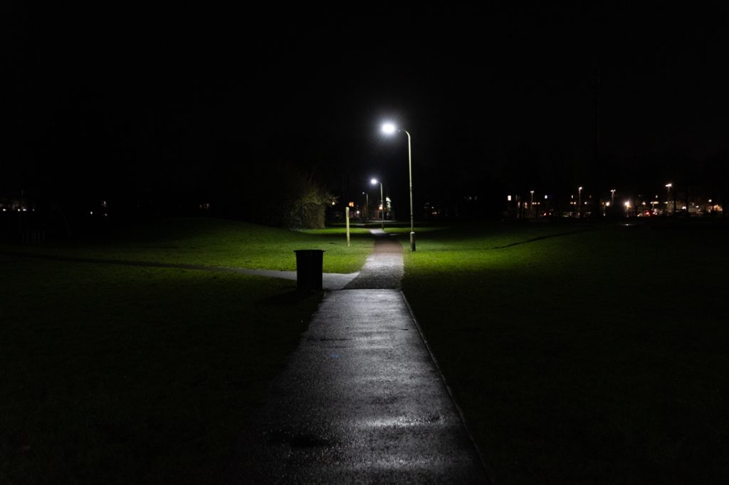
Source: Photo by authors of Illuminating Loughborough Project
Categories
Seedcorn Project

TraffEase

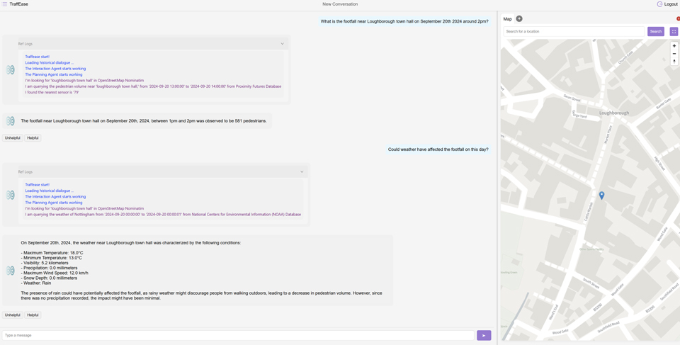
Image of the interface of Chat Loughborough. Source: Image provided by Chat Loughborough team

TraffEase (now called Aptiq) has evolved from a seedcorn‑funded research initiative into a robust platform known as Chat Loughborough capable of integrating multiple datasets into a single, user‑friendly tool. Its public launch through the Chat Loughborough platform as part of the TOWN Observatory made these insights openly accessible, which enables anyone to explore patterns of activity across the town. Collaboration with local authorities and partners strengthened throughout development, as stakeholders were engaged in demonstrations, testing and feedback. The success of the platform ultimately supported its transition into a commercial product, contributing directly to the formation of Aptiq (through Transhumanity Ltd) and facilitating its further £400k investment to scale deployment across the UK. 

Impact Achieved 

The project has already delivered significant economic and academic impact. Economically, the technology progressed from a research prototype to a commercial product with the creation of TransHumanity Ltd., which secured £400,000 in pre‑seed investment to scale Aptiq across the UK. This demonstrates clear commercial potential and positions the platform for broader adoption. 

Academically, the work has provided a real-world demonstration of agentic AI in the transport sector, contributing new insights into data interaction, AI deployment and human‑centred design. It has strengthened Loughborough’s profile in transport AI research, supported further funding success and received national recognition, including distinction as a Manchester Prize finalist and as one of the UK’s Top 40 tech start‑ups. 

Potential Future Impact 

Looking ahead, Aptiq has strong potential for further economicsocietalcultural and sustainability-related impact. The recent investment will help local authorities achieve faster, more evidence‑based decision-making by transforming time‑consuming analyses into rapid insights that support business case development, congestion management, road‑safety planning and net‑zero transport strategies. Early test deployments with Nottingham City Council and Transport for Greater Manchester indicate clear public service benefits, and the platform is expected to scale to additional regional and national authorities, including those linked to Loughborough. 

Societal and cultural benefits are also anticipated, as the platform’s conversational approach widens public access to urban data and enriches the TOWN Observatory’s engagement with the community. Residents, businesses and community groups will be able to understand town‑centre activity more easily, improving local decision-making, event planning and community cohesion, with additional accessibility potential through voice‑based interaction. 

Finally, Aptiq may contribute to sustainability goals by enabling more efficient analysis of trends relevant to net‑zero planning, congestion reduction and improvements to pedestrian and mobility infrastructure. By supporting evidence‑based decisions, the platform can help authorities target sustainable travel initiatives and advance environmental objectives.

Project team and roles

Dr Haitao He (Lead Investigator)
Dr Hui Fang (Co-lead Investigator)
Richard Sun
Yifan Wang
Fouroy Deng
Haoyu Wang
Rowan Davies
Stefano Sarti

https://www.transhumanity.ai

News

Loughborough University Spinout TransHumanity secures £400k for the first agentic AI platform for transport data

Categories
Seedcorn Project

Loughborough Observatory for the Visualisation of the Natural and Built Environment (LOVE)

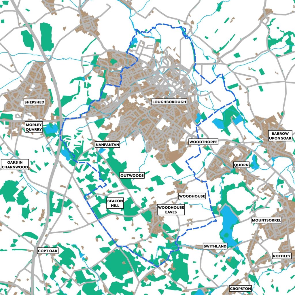
LOVE Area image, source: image owned by project.

About the project

Project summary: Our project aims to create an interactive, inclusive, and accessible digital trail, using StoryMap, that will link Loughborough Town with Charnwood Forest Geopark, via Loughborough University. This tool will provide members of the community with an opportunity to explore their relationship with local history and the natural environment, whilst living healthy and active lives. 

Impact Summary 

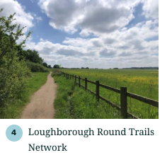
The LOVE project delivered a range of digital, engagement, physical, and partnership outcomes, including a comprehensive ArcGIS StoryMap (Loughborough Round Trails Network) featuring 12 public walking routes, including some accessibility variants, supported by a Strava group and a soon to be available printable route leaflet. Community engagement included an in‑person consultation event in Loughborough and a heritage survey yielding 34 responses. Physical outputs in progress include the introduction of a Loughborough University campus information hub and wayfinding/interpretation panels to support on‑site navigation, which is expected to be implemented and officially launched later in 2026. Institutionally, the project has been showcased through Charnwood Forest Geopark’s research pages and aligns with the University‑Geopark collaboration agreement, strengthening community links as the Geopark advances toward UNESCO Global Geopark status.

The project has generated multifaceted pathways to impact spanning academic, societal/community, cultural, economic, and environmental & sustainability domains, including new interdisciplinary research collaborations and integration into the TOWN Observatory framework (academic), meaningful community participation in shaping heritage routes and improved accessibility and representation of local narratives (societal/community), activation of Loughborough’s cultural assets through linked heritage trails and forthcoming interpretation infrastructure (cultural), early signs of supporting local footfall and aligning with regional tourism and investment initiatives (economic), and promotion of low‑carbon, transit‑aware movement alongside improved public understanding of local geodiversity and biodiversity (environmental & sustainability).

Future impact could be evidenced through:

– The project’s methods being adopted in other university or council initiatives.
– TOWN Observatory users (e.g. local community groups/councils) drawing on trail data for planning. 
– Trail route design changes shaped by public feedback.
– Increased StoryMap and route engagement, and uptake by schools or heritage groups.
– Partnerships with local institutions and, once installed, usage of new on-campus interpretive hub or panels. 
– Business testimonials and joint promotional activity with Town Deal partners. 
– Inclusion of the trails in active‑travel plans, educational use of geoscience content, and documentation supporting UNESCO‑aligned reporting.

Project team and roles

  1. Dr Guy Tallentire (Lead Investigator) Department of Geography and Environment 
  2. Dr Helen Glanville (Co-Investigator) Department of Geography and Environment
  3. Dr Matthew McCullock (Co-Investigator) Department of International Relations, Politics and History
  4. Dr Jack Matthews (Co-Investigator) Geoheritage Conservation and Interpretation Officer, Charnwood Forest Geopark 
  5. Rich Fenn-Griffin (Co-Investigator) Assistant Gardens Manager and Biodiversity Lead
  6. Paulina Loreta Jara Osorio (Research Associate) Department of Geography and Environment
  7. Saskia Huxham (Research Associate) Department of Geography and Environment
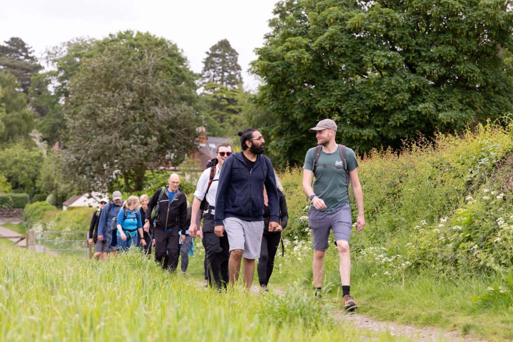
Walking image, source: Charnwoodforest