About the project
Heritage mapping is a project with the Loughborough Library Local Studies Volunteer Group (LLLSVG). Known for researching local history, promoting heritage activities in the town, and hosting exhibitions at the Loughborough Library, collaboration with LLLSVG is key to enriching two of the TOWN Observatory platforms: Loughborough Stories and Colouring Loughborough.
For the Colouring Loughborough platform, a team from LLLSVG has uploaded substantial amounts of information, categories, and historical data to the platform. Regarding the Loughborough Stories platform, members of the team have contributed their historical expertise, heritage insights, and lived experiences to create three distinct ArcGIS StoryMaps published on the Loughborough Stories platform.
Platforms
Loughborough Stories
Colouring Loughborough
Key Activities
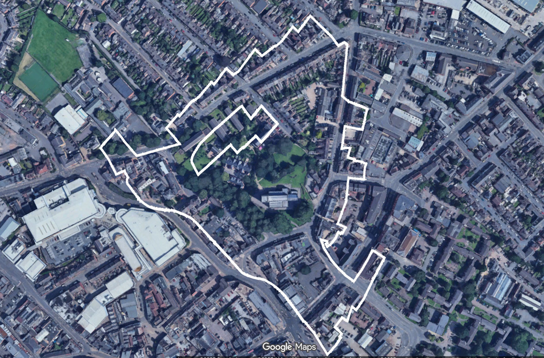
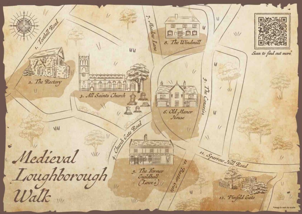
1. The creation of the Medieval Loughborough Trail
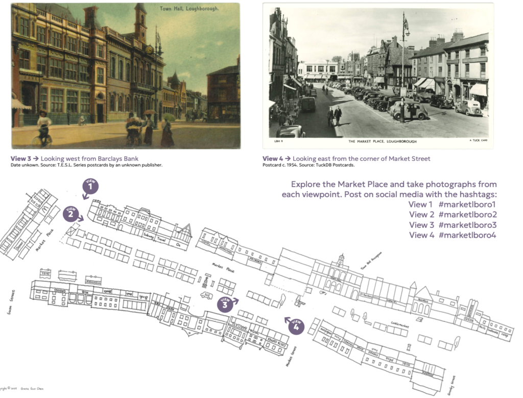
2. StoryMaps and printed materials for Medieval Loughborough Trail, Art Deco Trail and Market Place.
3. Integration of historical building data into the Colouring Loughborough platform.
4. Delivery of an AI and audio storytelling workshop series. LLLSVG members received training in creating AI-generated podcasts, enhancing their skills and engagement.
5. The TOWN Observatory’s participation in the Loughborough Heritage Open Weekend in September 2025, comprising two activities. (i) The TOWN Observatory team gave a series of public presentations, sharing the developments of the initiative across different platforms. (ii) Development and distribution of a information about the TOWN Observatory, and a promotional leaflet (see link below) containing a map to supplement the newly launched Medieval Loughborough Walk organised by the LLLSVG.
6. The TOWN Observatory’s invitation to participate in the Loughborough Heritage Forum by LLLSVG.
7. Creation of a TOWN Observatory Institutional Repository access for the LLLSVG team to enable archiving of relevant documentation.
Key people that enabled the partnership

LLLSVG Project team and roles
Sharon Gray · Team Organiser & Researcher
Kathy Phillips · Deputy Team Organiser & Researcher
Yvonne Casswell · Researcher
Lynne Dyer · Researcher
Christine Harris · Researcher
David Kirkby · Researcher
Sue Selfe · Researcher
Nigel Bampton · Photographer
Watch the Art Deco, Medieval Loughborough and Market Place StoryMaps


Download the Medieval Loughborough Trail and Art Deco Trail information and maps as A3 folding leaflets

Hear from members of the LLLSVG project team
We walked around Medieval Loughborough and we had three sessions which were totally sold out … and then to give people these leaflets, I should never forget their reaction when a woman said ‘wow, this is fantastic.’
David Kirkby, LLLSVG member
Learn more about the Heritage Mapping project through this Living Knowledge Network webinar for the British Library

News
Empowering the Loughborough Library Local Studies Volunteer Group with AI and Audio Stories
StoryMaps Workshop with the Loughborough Library Local Studies Volunteer Group
Loughborough Library Local Studies Volunteers Partner with Loughborough University

Impact summary
The project has begun to deliver wide-ranging impacts. Economically, it has created tourism opportunities and the potential for planned future revenue streams through the Medieval Loughborough trail. Productivity has been enriched as volunteers gained digital skills and streamlined heritage data processes. Cultural impacts included preserving local narratives (via the TOWN Observatory repository) and fostering community pride through innovative StoryMaps and audio stories. Learning and participation expanded through both workshops for LLLSGV and heritage events (e.g. the TOWN Observatory’s involvement in the Heritage Open Weekend), while practitioners gained ethical, co-created resources, which could create a pathway for the potential development of a replicable toolkit for broader application.
Public policy can benefit from data informing urban planning and conservation strategies. There is clear potential for environmental benefits from promoting sustainable tourism via the extremely popular walking tours. Additionally, heritage engagement can lead to improved quality of life and improved mental wellbeing through physical activity and social interaction of the walking tours.
Useful links from LLLSVG

Loughborough through time features old maps of Loughborough laid over the town between 1883 to 1975.